
The Kamaishi Yamada Road and Sanriku Jukan Expressway were the evacuation route for children running from tsunami surging towards Unosumai Elementary School and Kamaishi Higashi Middle School of Iwate. The filling between Sendai-Tobu Road and Fukushima’s Route 6 Soma Bypass served as a coastal levee. In addition Iwanuma’s Terashima district residents in Miyagi escaped hardship by evacuating on top of Abukumagawa River’s levee. Furthermore, Michi no Eki (roadside station) were used as relief supply relay stations by many evacuees for food, water and information. They protected the lives and offered support to all disaster victims.
Our role Record of the role of roads and levees
Function as “Road to Life”.
The children escaped hardships, Kamaishi Yamada Road.
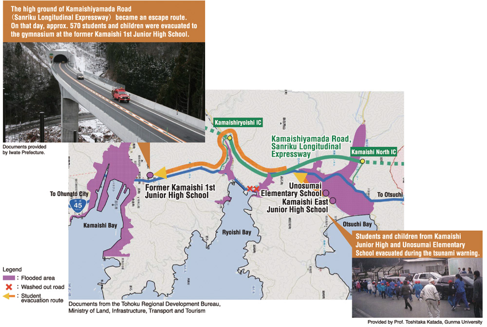
Iwate’s Unosumai Elementary School and Kamaishi Higashi Middle School were damaged by tsunami which came through Ootsuchi Bay. All 570 students were, however, saved as they evacuated to high ground of Kamaishi Yamada Road stretching throughout Sanriku Jukan Expressway. On top of that they used the same road to reach the shelter, gymnasium of former Kamaishi Daiichi Middle School. This road was also used for the supply transportation and saved the area from isolation.
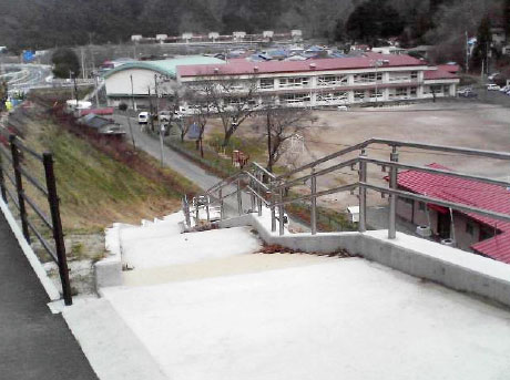
Emergency stairs saved the lives of children.
Omoto Elementary School of Iwate was flooded by tsunami, but its 88 pupils used the emergency stairs towards Route 45 to reach higher ground and escaped with their lives. These stairs were built only two years prior to the earthquake (2009) literally becoming the road to life.
Disaster drill(2010.9.3)
Source: the MLIT Tohoku Regional Bureau

130 step emergency stairs(2009.3.25)
Source: the MLIT Tohoku Regional Bureau
Highway as coastal levee
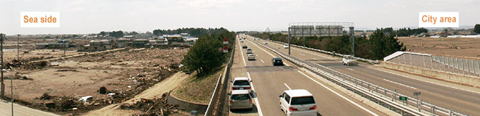
Sendai-Tobu Road saved the city from flooding by tsunami.
2011.3.12
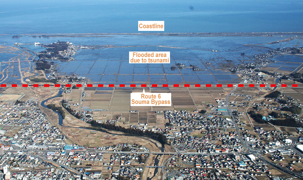
Since the south central area of Miyagi, including Sendai, is a flat area, tsunami ran as far as 4 km through the area. However, it was finally tamed by the embankment structure (7-10m) of Sendai-Tobu Road saving the city from tsunami and the rubble. This road, running the eastern part of Sendai from north to south, became coastal levee substitute. In addition, about 230 people escaped from tsunami by reaching the high ground between Sendai Wakabayashi JCT and Natori IC. The embankment area of Route 6 Soma Bypass at Fukushima’s Soma City also worked as coastal levee saving the city from flooding.
Levee protected and supported the citizens.
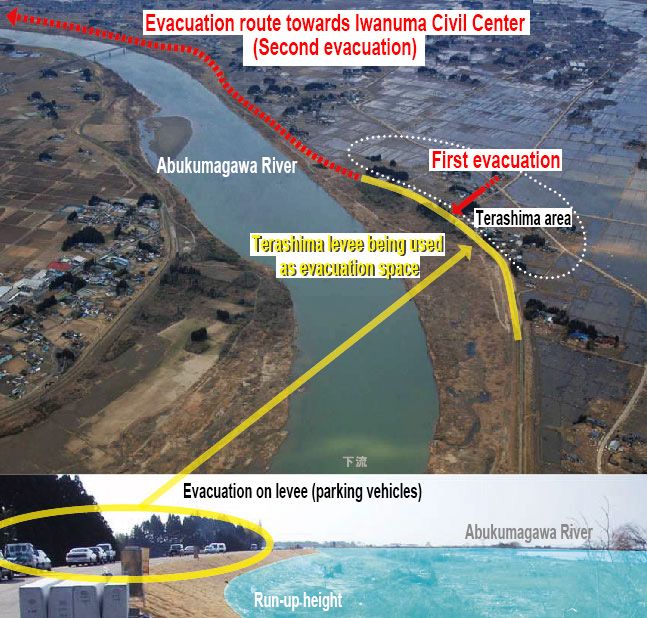
Citizens escaped from tsunami thanks to Terashima levee.
Nakashita Levee, as an evacuation route to community center
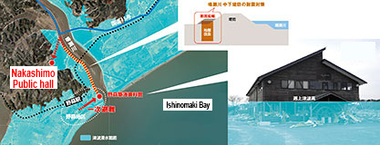
Since the land around Terashima district in Iwanuma, Miyagi, situated at the estuary of Abukumagawa River, is completely flat there was nowhere to run up. After the major tsunami warning, 50 residents evacuated to the Terashima levee of Abukumugawa River. Though they were caught in-between the run-up from river and tsunami, the waves could not overtake the sturdy levee. Suffering no casualties evacuees reached the shelter in Iwanuma’s civil center via the same levee. At the same time about 80 residents of Matsuhima’s Nobiru area evacuated to the second floor of Nobiru Port Museum near Narusegawa River and later reached the Nakashita community center via Nakashita levee. Both levees were built with seismic measures in mind and managed to withstand both the earthquake and the tsunami that followed.
Significant reduction of tsunami by breakwater.
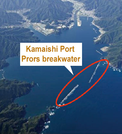
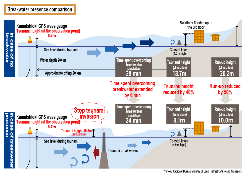
The breakwater of the Port of Kamaishi has reduced tsunami by about 40%.
At the mouth of Kamaishi Bay there were two breakwaters stretching from north to south. Though the northern breakwater was 990 m and southern was 670 m long both were destroyed by tsunami. However, their destruction was not in vain as they succeeded in delaying and suppressing the tsunami’s run-up height. From the GPS wave gauge data from offshore of Port of Kamaishi it was calculated that without the interference of breakwaters the tsunami at Kamaishi Bay would have been 13.7 m tall. However, since the actually observed height was only 8.1 m it was reasoned that breakwaters succeeded in reducing the tsunami by about 40%.
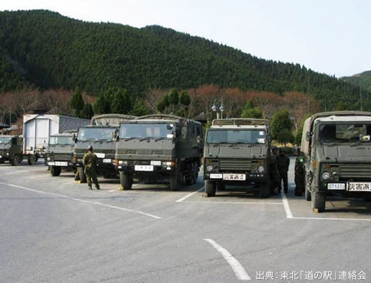
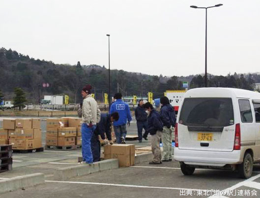
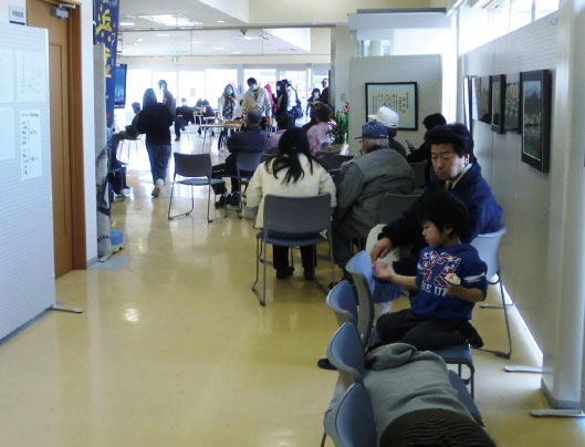
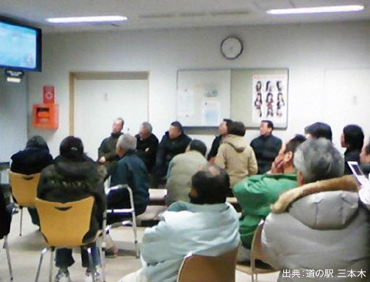
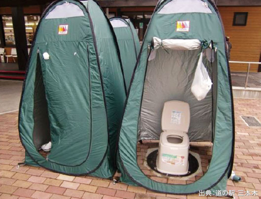
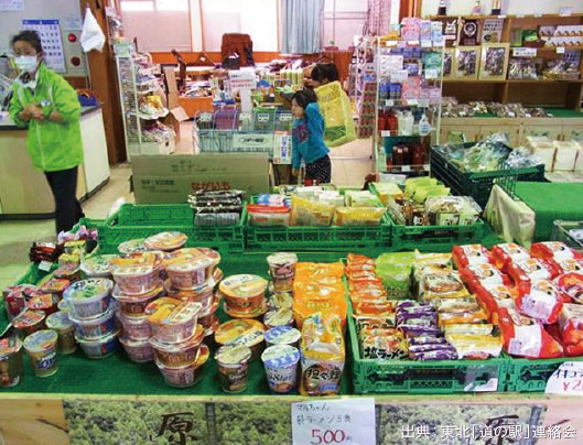
Michi no Eki (roadside station) was used for evacuation.
Michi no Eki (roadside station) welcomed evacuees with food, water and vital information.
Tohoku’s Michi no Eki (roadside station) have welcomed evacuees after the disaster.
They supplied everything from food and water to temporary toilets and information, such as current traffic regulations. They were also used as relay stations for relief supplies as well as served as gathering and resting places for volunteers of the relief effort.
The Miyagi’s Michi no Eki “Sanbongi” in Osaki and Iwate’s Michi no Eki “Tarou” in Miyako have been prepared for exactly such function before the actual disaster and still serve with disaster prevention in mind today.
Michi no Eki, Tsuyama
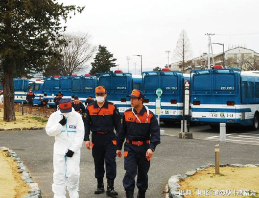
Michi no Eki, Soma
Michi no Eki, Soma
Michi no Eki, Minami Soma
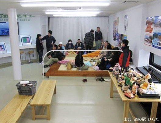
Michi no Eki, Hirata
Michi no Eki, Sanbongi
Michi no Eki, Sanbongi
Michi no Eki, Yamada

Michi no Eki, Yamada